Trekking to the "Chinese Wall" of Finestres
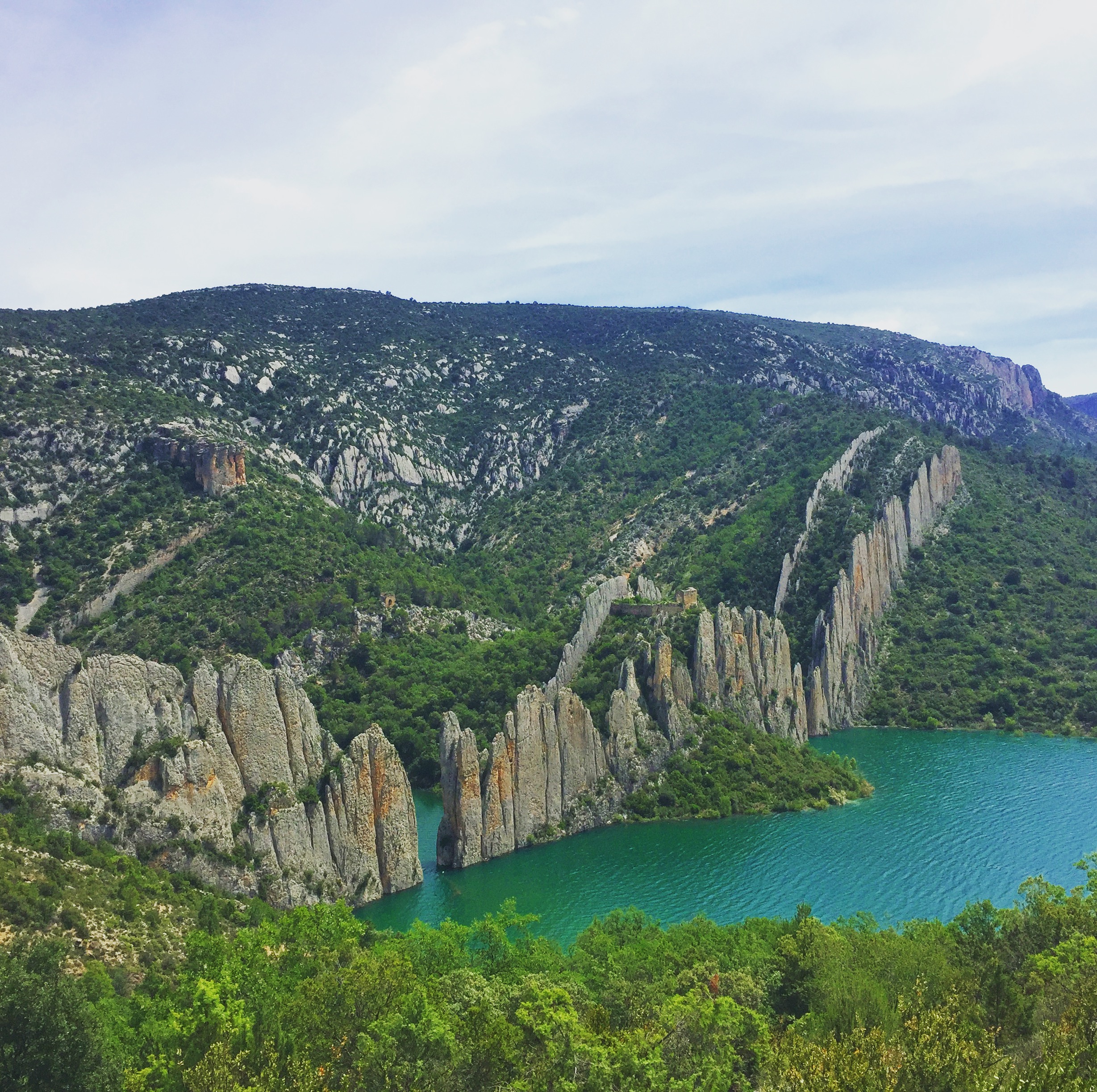
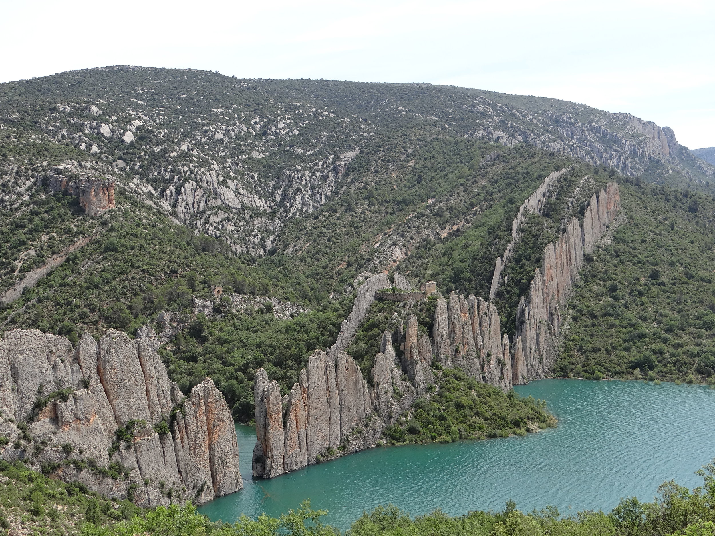
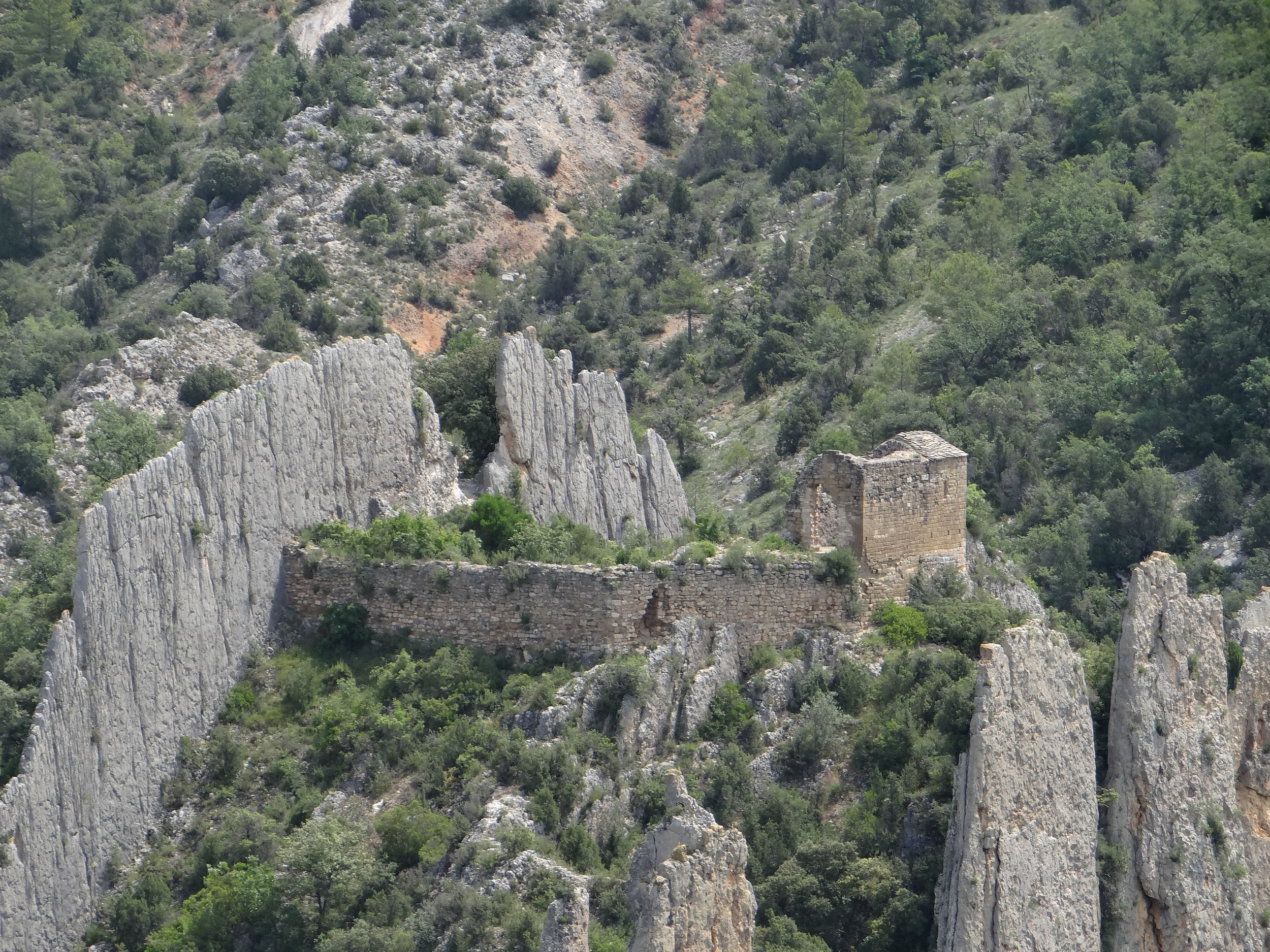
The “Chinese Wall” of Finestres is, in fact, neither a wall, in the strict sense of the word at least, nor in China. Yet, when you see how it looks like, you can understand why this name has stuck.
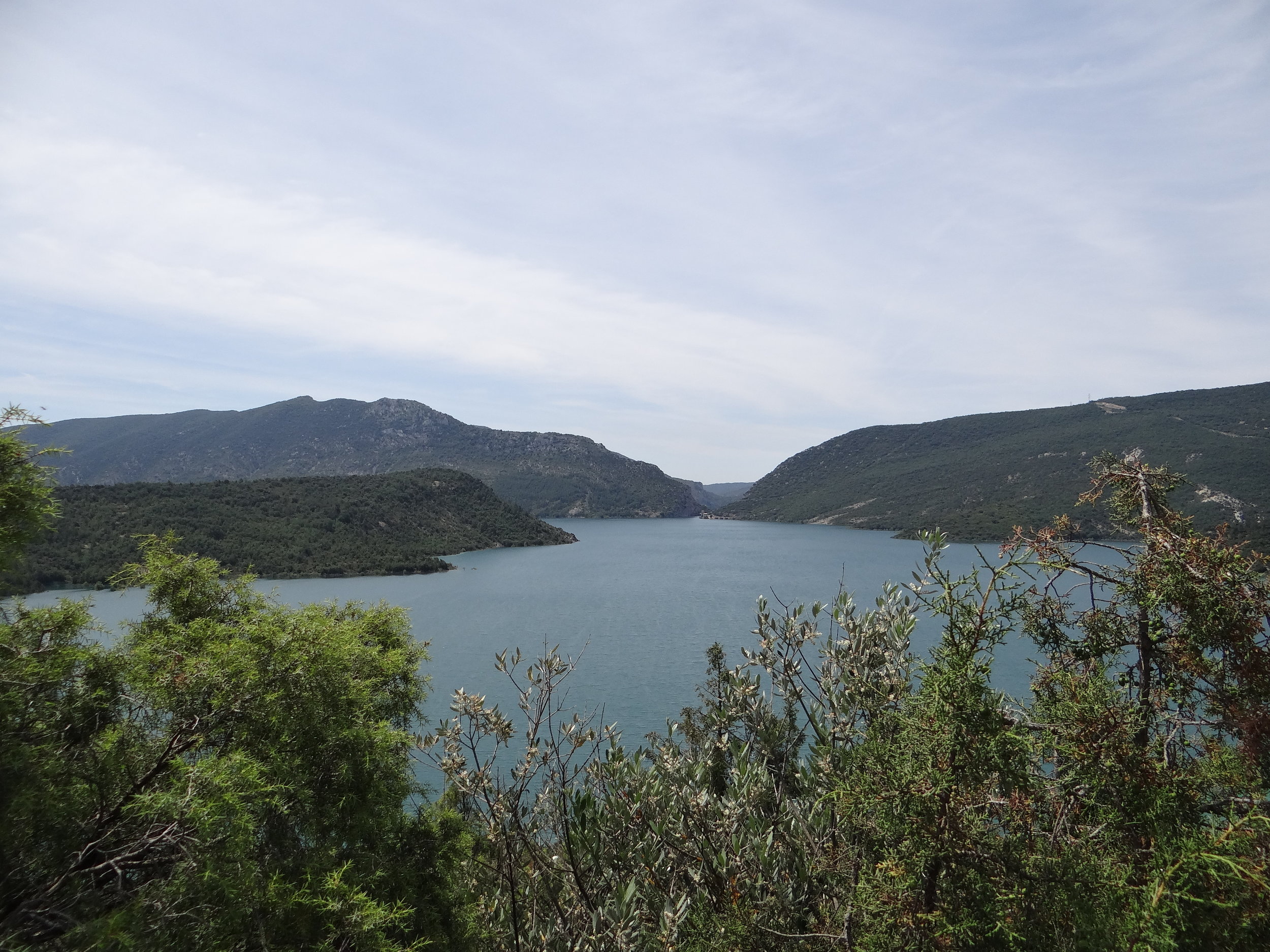
The lands on both sides of the Ribera Ribagorçana river, that demarcates the border between Catalonia and Aragon, 200km West of Barcelona, hide some truly amazing natural wonders that have, so far, escaped the attention of the masses. The Wall of Finestres, a peculiar rock formation that straddles one of the arms of the huge Canelles reservoir, is one of them.
This area is at the Western edges of a mountain range called the “Montsec” (which means “Dry-Mountain” in Catalan language), one of the mountain ranges of moderate height that run parallel to the Pyrenees.
Rural exodus hit these mountain areas in the Aragon-Catalonia borderlands particularly hard. In fact, it would not be totally inaccurate to refer to the area surrounding the Canelles reservoir as a sort of wilderness.
This has, at the same time, been a blessing in the sense that these magnificent landscapes have been preserved pretty much intact and those that come to admire them in person are still few.
How to get to the “Chinese Wall” of Finestres?
By land
It is possible to reach the abandoned village of Finestres by car, and from there it’s just a few hundred meters to the best viewpoints…but, be warned! the only way is through an unpaved road that may not always be in the best condition.
The direct route would take you from the town of Estopanyà, and through a bridge over the river Guart, all the way through an unpaved track to Finestres.
However, on the day we visited, sections of this track were impassable due to heavy rain on the previous days, so we took instead an alternative and much longer route. Starting much more to the North, in the hamlet of Viacamp, which sits right next to a major road (N-230). From there is another unpaved track that traverses a long ridge on the Western side of the reservoir. The track is some 20km long, but it takes over an hour to drive, because the track is steep at times and some sections have a rather irregular ground, with plenty of scattered rocks. Yet, it was dry and we managed to drive through with ordinary cars.
By kayak
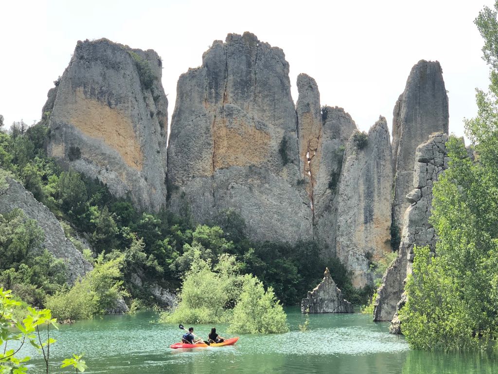
There is another way, possibly more picturesque, and it is to join a kayak expedition organized by one of the several local active tourism operators.
The abandoned village of Finestres
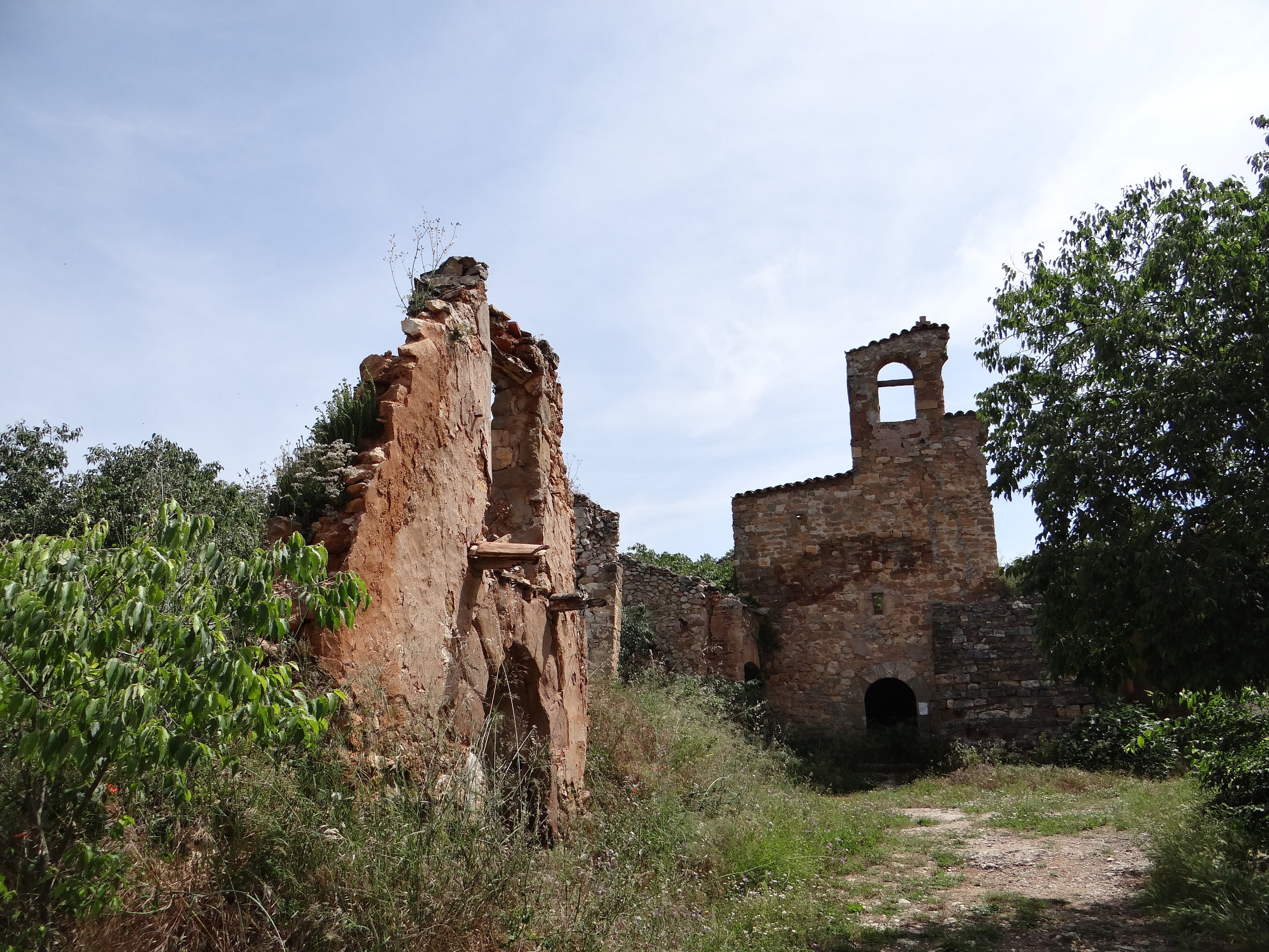
The end point of our drive and the start of the walking part of our expedition is the abandoned hamlet of Finestres.
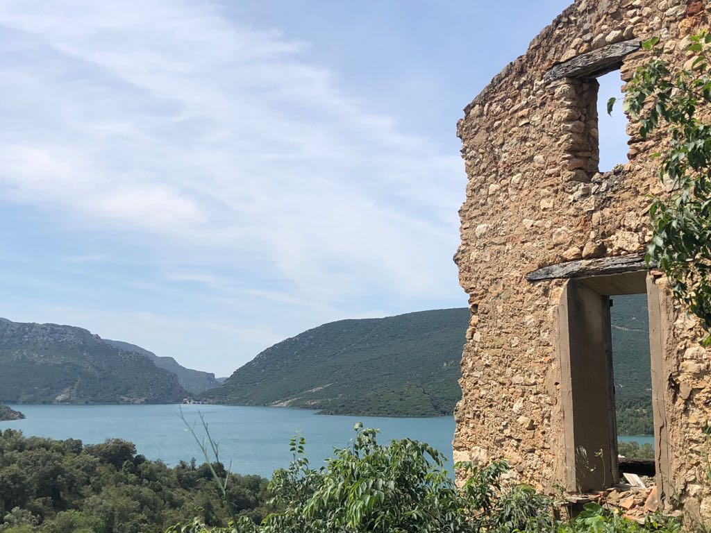
The landscape here is what you would expect in a place that has been devoid of any permanent inhabitants for over half a century: the ruins of what once was a thriving community, complete with a 17th Century church, totally overgrown by vegetation…or almost. There is, apparently, one house that is still inhabited in the summer.
The village, on its own, makes for quite a suggestive place, and it also has some nice views of the Canelles reservoir, but we did not come here for this.
The first part of the trek was to cover the roughly 200m from the abandoned village of Finestres to the nearby Saint Mark chapel, located on a small hill overlooking the large man-made lake, that stretches as far as the eye can see.
And it is also from here, that we got our first glimpse of the spectacular “Chinese Wall”…
The Wall of Finestres
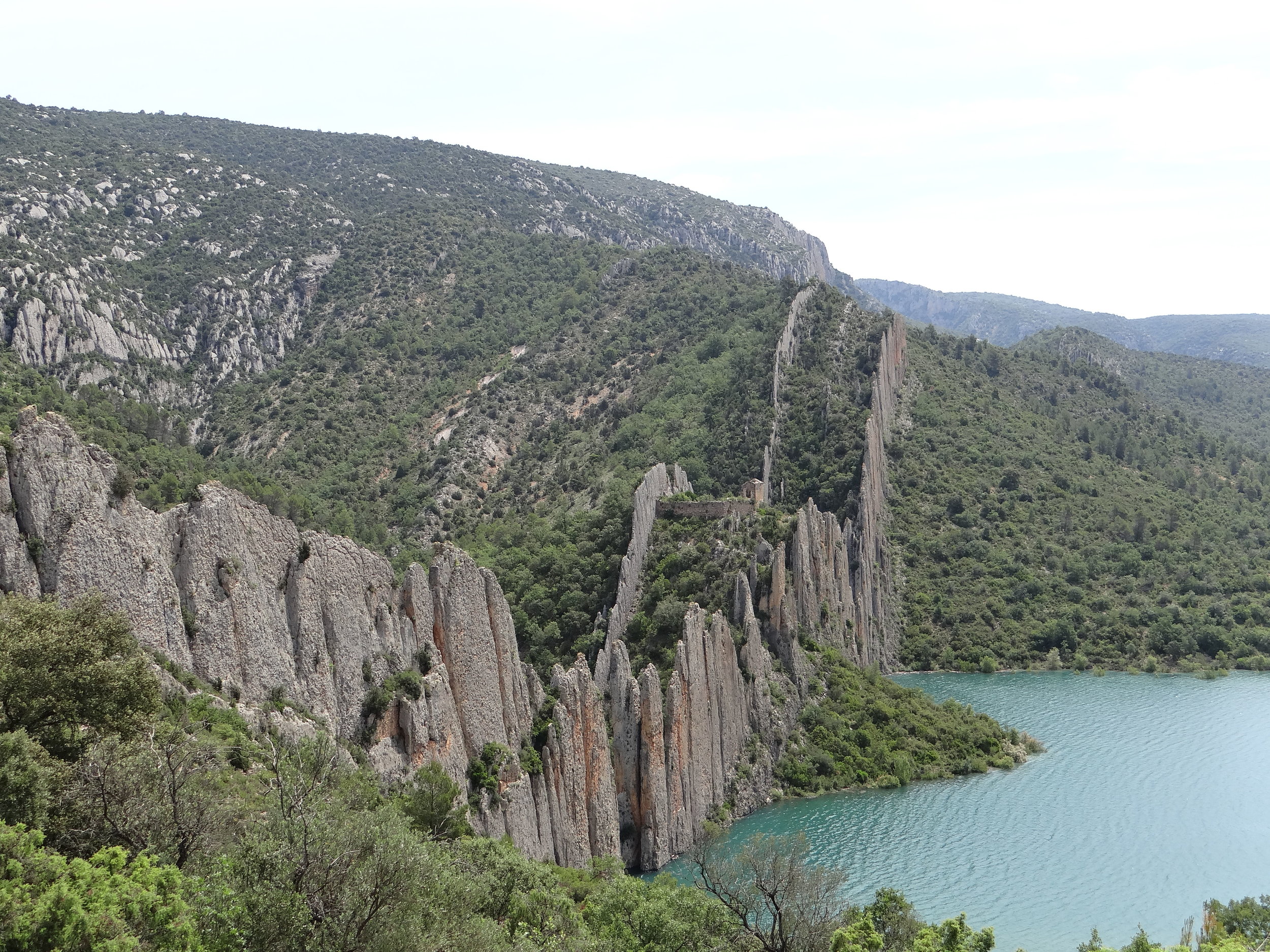
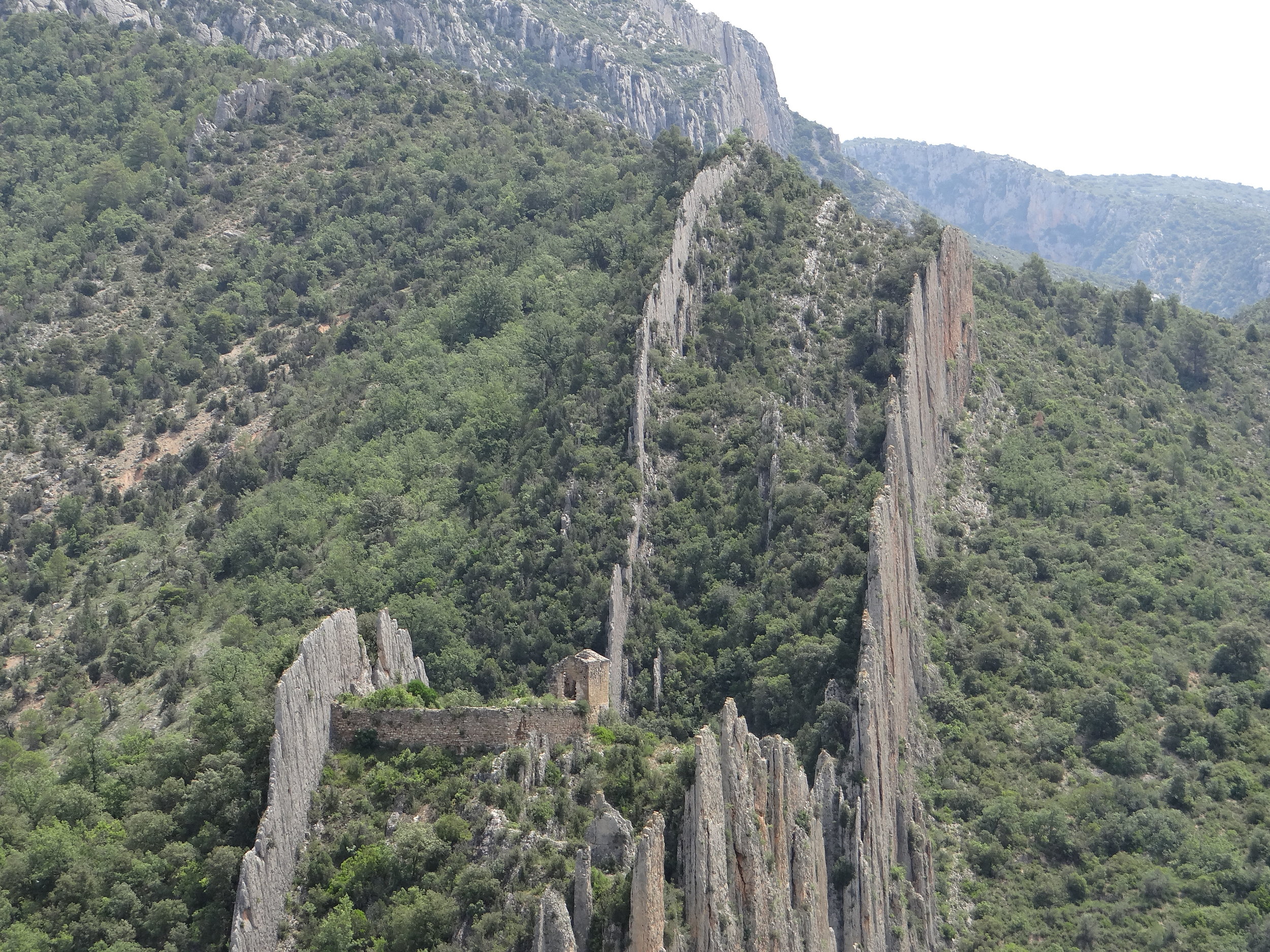
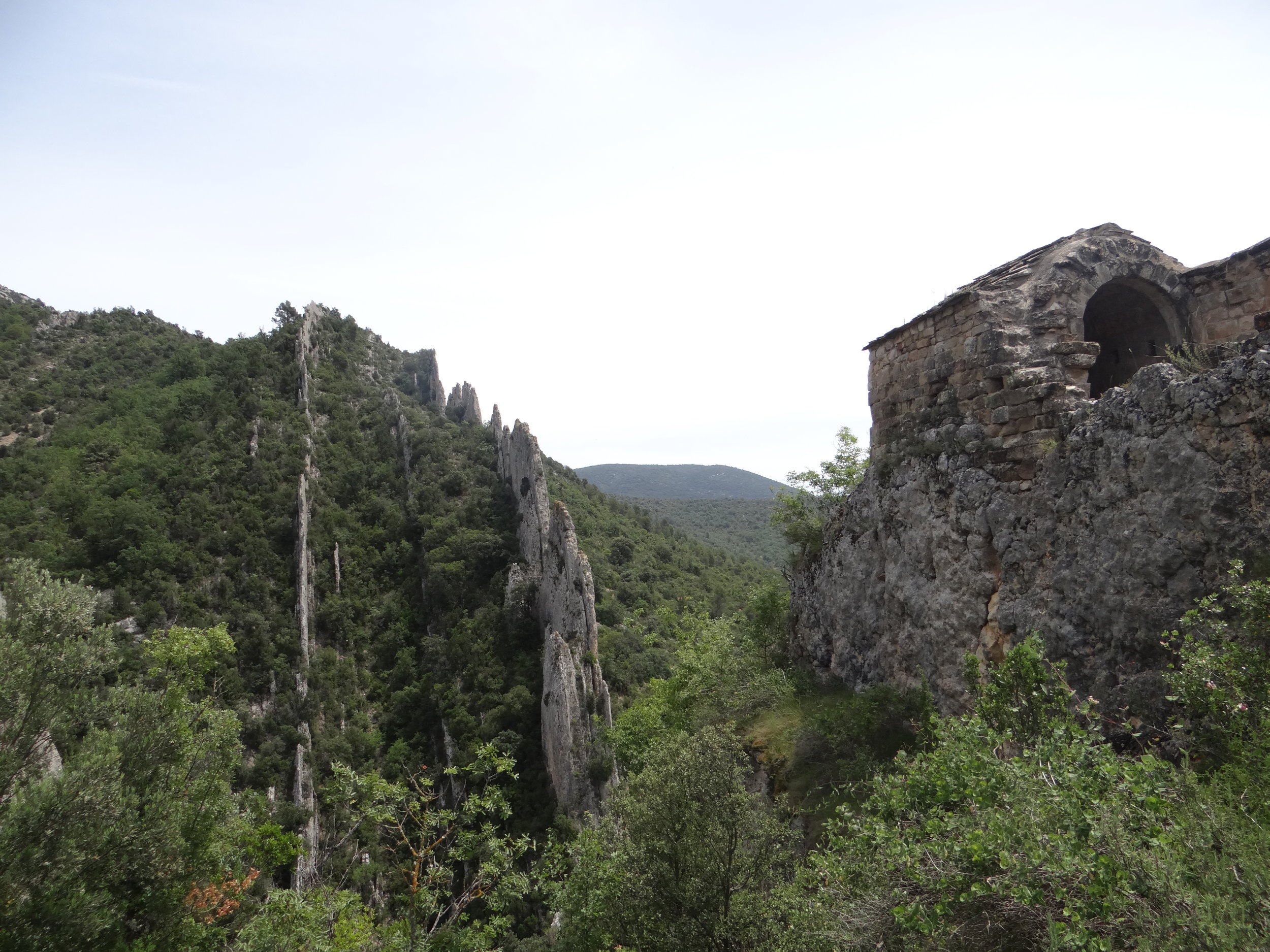
The so-called “Chinese Wall” is actually a two parallel lines of vertical mineral strata that run along one of the edges of the Canelles reservoir, partly enclosing one of its lateral arms, and creating, when the waters are high, a sort of secluded bay.
Adding to the spectacular ensemble, a XI Century Romanesque church crowns the highest point at the center of the wall. The church of Saint Vincent (Sant Vicenç de Finestres) was built right in the space between the two walls of rock.
From Finestres, there is a trail that takes you to the church of Saint Vicenç by making a detour around the very steep hillsides, yet, we decided to try the direct route and went straight for the water, heading for the bottom of the ravine that lays at the bottom of the wall, in the hope to find a passage along the shore or, at least to go for a swim (it was summer!). (Warning: although not technically complicated, it is quite a steep descent and there is not a well designated trail!)
What we did not count on was the water level, which at the time were quite high (due to a rather snowy and rainy winter and spring.
At this point the Canelles reservoir has a small side arm that, with low water levels is possible to walk around and get to the trail that leads up to the Wall and the church of Sant Vicenç, but with the water a crossing on foot was out of the question. There was still the option to swim, but we would possibly need to leave bags and cameras on the near shore.
Luckily, a group of kayakers just showed up at the right time and helped us to get across the few meters of water that separated us from the other side.
From this point is a 10 minute uphill walk to the central part of the Wall.
A gap in the “Chinese Wall” gives access to the picturesque romanesque church, built in the Lombard style that was common in these lands at the turn of the 11th Century. Again, the trek does not require much technical expertise or equipment, although it is quite steep and at some points it requires climbing over rocks. In particular, the last stretch, to enter the space between the two parallel lines of rock that make “the wall” requires going through a 2-meter high metal staircase that has been afixed to the rock.
If the views of the Wall are quite amazing from the outside, there are also some amazing views from the inside…
There was also time for a bath before making our way back…
